6 U S BATES ROAD
Owner Information
ALESSI KRISTINA
6 U S BATES ROAD
HINGHAM, MA 02043


Property Details
6 U S BATES ROAD is classified as a Single Family Residential (Cape cod).
The primary structure on this property was built in 1945. There are 3,550ft2 of built area within this property. There is 1,030ft2 of residential/living space within this property. This property is listed as having 5 rooms.
6 U S BATES ROAD is valued at $618,800. The land is valued at $353,800 and the structures are valued at $265,000.
This property is in Zone RB. Confirm with local Zoning Board authorities to ensure there are no overlays or other easements on this property.
The most recent deed for 6 U S BATES ROAD is recorded at the local registrar in Book 0626, Page 0149. 6 U S BATES ROAD was last sold on Tuesday, June 27, 2017 for $640,000.
Assessment data from fiscal year 2022.
Flood Data
According to the FEMA National Flood Hazard Layer, this property does not appear to be in a flood zone. It may also be in an area not yet reviewed. Nonetheless, confirm this information prior to taking any action.
To view the flood hazards around this property, create a FEMA "Firmette" Map of the area around 6 U S BATES ROAD.
Broadband Internet Providers
| Provider | Type | Bandwidth (mbps) | |
|---|---|---|---|
| VSAT Systems, LLC. | Satellite | 2 | 1 |
| HughesNet | Satellite | 25 | 3 |
| GCI Communication Corp. | Satellite | 0 | 0 |
| Comcast | Cable | 1000 | 35 |
| Verizon New England Inc. | Fiber | 940 | 880 |
| Verizon New England Inc. | DSL | 5 | 0 |
| Viasat Inc | Satellite | 100 | 3 |
Broadband service provider data from December 2020.
Adjacent Properties
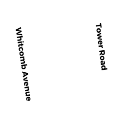
- 29 WHITCOMB AVENUE
Single Family Residential owned by BURTON JOSEPH W & LEE B - 21 WHITCOMB AVENUE
Single Family Residential owned by KONDRACKI ALEXANDER A & JOAN - 8 U S BATES ROAD
Single Family Residential owned by ROOF WILIAM & - 16 U S BATES ROAD
Single Family Residential owned by WARD FRANCIS V III & KATHLEEN M WARD - 1 ROANOKE LANE
Single Family Residential owned by GILMAN ROBERT JR & JENNIFER